
Ethno-Eco Trek: The Himalayan Lab
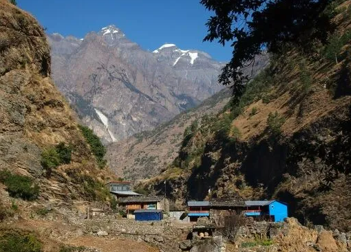
A trek designed for university students researching Himalayan ecology or Himalayan culture, and for the field visits their courses ask of them. Academic pursuit on one hand, adventure on the other, on a trail that passes from subtropical gorge to alpine pasture through some of the last Tibetan Buddhist villages in Nepal.
Days are structured for fieldwork: time in the villages of Nubri for interviews and observation, time in the forest and on the moraine for ecological study, and evening seminars with your guide, who is from these villages. We plan to partner with universities abroad, especially departments of anthropology; supervisors are welcome to shape the itinerary with us.
Unlike a conventional trek, the pace is deliberately slower, allowing time to observe, engage, and understand the landscapes and communities along the way. Each day combines walking with fieldwork-recording observations, conducting interviews, collecting samples where appropriate, and exploring local knowledge and everyday life. Evenings bring everyone together around the lodge table for a shared seminar, reflection, and discussion of the day’s discoveries.
A licensed guide from the Gorkha district on every departure
Two to ten walkers, one porter for every two
Breakfast, lunch and dinner on every trekking day
- Highest point
- 5,106 m · Larkya La
- Grade
- Demanding
- Best season
- Mar – May · Oct – Nov
- Starts and ends
- Kathmandu
Ethno-Eco Trek: The Himalayan Lab is a unique field-based trekking experience designed primarily for university students, independent researchers, and curious minds seeking to explore the intricate relationship between Himalayan communities and their natural environment.
Nestled in the Manaslu region of northern Nepal, the trail passes through diverse ecological zones, dramatic landscapes, and traditional settlements where indigenous communities continue to maintain distinctive cultural practices, livelihoods, and relationships with nature. From forests and alpine pastures to glacial landscapes and high-altitude villages, the region offers a valuable setting for exploring questions of ecology, anthropology, cultural heritage, climate change, and sustainable living.
More than a trekking adventure, this journey invites participants to observe, engage, question, and learn from the Himalayas themselves. Through encounters with local communities and first-hand observation of the surrounding environment, participants gain a deeper understanding of how people adapt to life at high altitudes and how traditional knowledge, changing environmental conditions, and modern development shape the future of Himalayan societies.
At Drokpo Treks and Adventures, we believe that some of the most meaningful learning happens beyond the classroom. The Himalayan Lab is an invitation to experience the Himalayas not merely as a destination, but as a living landscape of knowledge, culture, and ecological discovery.
Touring Information
- 👥 Discover the traditions, lifestyles, and cultural heritage of Himalayan communities.
- 🌱 Explore forests, alpine meadows, glacial landscapes, and high-altitude ecosystems.
- 🏔️ Learn about pastoralism, farming, seasonal migration, and mountain survival.
- 🌍 Observe the changing Himalayan environment and its implications for local communities. Culture, Spirituality, and Nature
- 📝 Connect academic concepts with direct observation, field notes, and local encounters.
- 🎓 Engage with anthropology, ecology, geography, sociology, and environmental studies.
- 🍃 Appreciate local knowledge while respecting cultural traditions and ecological conservation.

Arrive in Kathmandu, where you will be welcomed by the Drokpo team and transferred to your hotel. The day is reserved for settling in, resting after your journey, and receiving an introduction to the upcoming Himalayan expedition. Participants will meet their fellow travellers and learn about the Manaslu region, its cultural diversity, ecological significance, and the principles of responsible field learning.
Travel from Kathmandu towards Machha Khola through the hills, river valleys, terraced fields, and rural settlements of central Nepal. The journey offers an introduction to the geographical and social transitions between the Kathmandu Valley and the Budhi Gandaki corridor. As the road follows the river upstream, participants begin observing how terrain, access, settlement patterns, and infrastructure shape everyday life in mountain communities.
Begin trekking along the Budhi Gandaki River, crossing suspension bridges and following forested trails through scattered settlements and cultivated slopes. The route gradually reveals how communities adapt their agricultural practices and daily routines to the narrow river valley. Philim provides an opportunity to observe traditional settlement patterns, local livelihoods, and the relationship between mountain terrain and community life.
Continue through forested slopes, rocky trails, river crossings, and increasingly mountainous terrain towards Deng. The route offers a closer look at how vegetation, land use, and settlement patterns change with elevation. Participants can begin comparing the ecological conditions of the lower Budhi Gandaki valley with those encountered farther into the Himalayan interior.
Trek farther into the upper Budhi Gandaki valley, passing traditional settlements, forested hillsides, and trails marked by mani walls, chortens, and other expressions of Himalayan Buddhist culture. The journey introduces participants to the gradual emergence of stronger Tibetan cultural influences and the importance of religious traditions in shaping the cultural landscape.
Continue through forests and traditional villages towards Namrung, where the landscape begins to feel distinctly alpine. The changing vegetation, building styles, agricultural practices, and cultural features offer opportunities to consider how altitude and historical connections have shaped the region. Namrung also provides a useful setting for reflecting on the relationship between geographical isolation, tourism, and cultural continuity.
Ascend through Himalayan settlements and increasingly open mountain scenery towards Lho, a traditional Nubri village with impressive views of the surrounding peaks. The journey provides a natural opportunity to examine how high-altitude conditions influence housing, food production, mobility, and local livelihoods. Arriving in Lho, participants can also appreciate the significance of monasteries, sacred structures, and Buddhist traditions in the cultural landscape.
Visit Ribung Gompa, the prominent monastery overlooking Lho, before continuing towards Shyala through a landscape of alpine vegetation, traditional settlements, and expansive mountain views. The monastery visit offers a chance to understand the role of Buddhist institutions in community life, cultural transmission, and local identity. As the trail approaches Shyala, the changing landscape provides further opportunities to observe the transition towards the high-altitude environment.
Begin the morning with magnificent views of Mount Manaslu and the surrounding Himalayan peaks from Shyala before making the short journey to Samagaun, also known as Sama. The remainder of the day focuses on exploring the village and learning about its settlement patterns, local livelihoods, educational environment, and changing social conditions. A visit to the local school, subject to arrangements and permission, can help participants reflect on education in remote mountain communities and the opportunities and challenges faced by students growing up at high altitude.
Spend a day in Samagaun to rest, acclimatise, and explore the cultural landscape at a comfortable pace. A short hike towards the monastery settlement offers opportunities to observe traditional architecture, religious practices, community spaces, and the close relationship between cultural life and the surrounding mountain environment. Participants can also organise field notes and reflect on observations gathered during the journey so far.
Pungyen Gompa: approximately 4,000 m | Manaslu Base Camp: approximately 4,800 m
Today offers a choice between two remarkable high-altitude experiences in the Manaslu region. Participants may choose to visit Pungyen Gompa, a monastery set amid a spectacular mountain landscape, to explore the relationship between Buddhist spirituality, cultural heritage, and the Himalayan environment. Alternatively, those seeking a more demanding mountain excursion may hike towards Manaslu Base Camp to observe the dramatic glacial landscape and reflect on the ecological significance of high-altitude environments. Each option offers a distinct perspective on the relationship between people, culture, and nature in the Himalayas. The selected excursion will depend on individual preference, fitness, weather, and trail conditions. Return to Samagaun.
Continue towards Samdo, passing through the high-altitude landscape near Birendra Lake, a striking glacial lake below the Manaslu massif. The lake provides a setting to consider glacial processes, mountain hydrology, and the environmental significance of high-altitude water bodies. The trail then opens towards the broad, windswept terrain surrounding Samdo, where traditional settlement and livelihood patterns reflect the challenges of living in a high Himalayan environment.
Today focuses on an in-depth study of Samdo, one of the region’s distinctive high-altitude settlements. Participants explore traditional livelihoods, seasonal mobility, local knowledge, and the village’s historical connections with Tibet through trade and cultural exchange. Through observation, interviews, and community engagement, the day examines how people sustain their lives and cultural practices in a challenging Himalayan environment. The afternoon allows time to review field notes and prepare for the crossing of Larkya La Pass, with acclimatization remaining an important part of the day.
Leave Samdo and follow the trail towards Dharmasala, also known as Larkya Phedi, the staging point for crossing Larkya La Pass. The landscape becomes increasingly rugged, with sparse vegetation, exposed slopes, and wide views of the surrounding mountains. This shorter but physically significant stage provides time to appreciate the fragility of high-altitude ecosystems and prepare for the demanding pass crossing the following day.
Begin early for one of the most demanding and rewarding days of the expedition. Cross Larkya La Pass amid vast mountain panoramas before descending towards Bimthang on the western side of the pass. The route reveals a dramatic transition between high glacial terrain and the landscapes beyond the pass. For participants, the crossing also offers a chance to reflect on how mountain barriers influence mobility, historical connections, and the movement of people across the Himalayas. The crossing remains dependent on weather, snow conditions, and the group's health and readiness.
Descend from Bimthang through the changing landscapes of the lower Manang region, walking towards Tilche. Along the way, observe the transition from high-altitude mountain terrain to forested slopes, river valleys, and lower-elevation settlements. Upon reaching Tilche, continue by local jeep to Besisahar, marking the end of the trekking section of the expedition. This journey offers a final opportunity to reflect on the ecological, cultural, and geographical diversity encountered throughout the Manaslu traverse.
Return to Kathmandu by road, bringing the high-altitude journey to a close. The drive offers a final opportunity to observe the contrast between remote mountain settlements and the urban environment. Participants may use the journey to review their field notes, identify key questions that emerged during the trek, and reflect on the relationships between geography, culture, ecology, and development.
Enjoy a well-deserved rest day in Kathmandu after the expedition. Participants can organise photographs and field notes, discuss their experiences, and reflect on the cultural and ecological themes encountered throughout the journey. This day also allows time for personal exploration, shopping, or an optional visit to one of the valley's cultural or heritage sites.
Depart Kathmandu with a deeper appreciation of Himalayan cultures, ecosystems, and the relationships between people and their environment. The journey concludes, but the questions, observations, and perspectives gained along the way can continue to inform academic work, personal research, and future exploration.
Important Note:
The 19-day Ethno-Eco Trek: The Himalayan Lab is designed as a field-based learning journey through the diverse landscapes and indigenous communities of the Manaslu region. Rather than focusing solely on reaching destinations, the itinerary encourages slow exploration, observation, interviews, documentation, and engagement with local knowledge, culture, livelihoods, and ecology. Daily field activities are complemented by evening discussions and reflection, allowing participants to connect their experiences with broader research questions. The itinerary includes time for acclimatization and preparation for high-altitude trekking. However, the schedule and activities may be adjusted due to unforeseen circumstances, including weather conditions, trail accessibility, health and safety concerns, or other local factors.

- Licensed, English-speaking local guide from the Gorkha district
- Porters at one per two trekkers, loads capped at 20 kg
- Manaslu Conservation Area and restricted-area permits
- Teahouse accommodation on trail, twin share
- Breakfast, lunch and dinner on every trekking day
- Private transport Kathmandu – trailhead – Kathmandu
- Three nights in Kathmandu, breakfast included
- Basic First-Aid Kit

Permits and paperwork
Yes, and it is not optional. The upper Manaslu valley is a restricted area, and the restricted-area permit can only be issued to a group of two or more trekkers travelling with a licensed guide through a registered Nepali agency. You cannot obtain one as an independent walker, and there is a checkpoint at Jagat where it is inspected. Solo trekkers are paired into a group before departure.
Three. The Manaslu Restricted Area Permit is US $100 per person for the first seven days from September to November, then US $15 for each additional day; from December to August it is US $75 for the first seven days and US $10 a day after. The Manaslu Conservation Area Permit is NPR 3,000 (about US $25), and because the trail finishes inside the Annapurna region you also need the Annapurna Conservation Area Permit, another NPR 3,000. We arrange all three; they are quoted separately from the trip price because the restricted-area fee depends on your dates and how many days you spend above Jagat.
The restricted-area permit is issued against your passport, so we need a scan of the photo page and two passport photographs before we can apply. Permits are issued in Kathmandu and cannot be applied for from the trailhead, which is why we ask for these at least a fortnight before departure.
You should not walk this trail without it, and it needs to cover trekking to the altitude you will reach as well as helicopter evacuation. Above Samagaun there is no road, and the only way off the mountain quickly is by air. Ask us what the policy needs to say if you are unsure — it is a question we answer most weeks.
Altitude and difficulty
The Larke La is 5,106 m, and crossing it is the hardest day of the trek: a long ascent starting before dawn from Dharamsala at about 4,460 m, then a descent of more than 1,500 m to Bimthang on the far side. It is not technical — there is no rope, no crampons in a normal autumn — but it is a very long day at altitude, often in wind, sometimes in snow. If you have walked to 4,000 m before and were comfortable, you will manage it.
The trail climbs from about 900 m at Machha Khola to 5,106 m at the pass, and our days are built around the standard guidance: no more than about 500 m of sleeping altitude gained per day once above 3,000 m, and a rest day roughly every 1,000 m. The acclimatisation day at Samagaun is walked rather than spent lying down — up towards Pungyen Gompa or Birendra Lake and back down to sleep, which is what actually helps.
Your guide checks how everyone is each evening, and the answer to worsening symptoms is always the same: go down. The valley loses height quickly, so descending is usually a matter of hours rather than days. Where it is not — above Samdo, on the approach to the pass — evacuation is by helicopter, which is why the insurance question above is not a formality.
Fit enough to walk five to seven hours a day, day after day, on uneven ground, carrying a daypack. The distances are not extreme; the accumulation is. Hill walking with a pack in the months before you come is worth more than any amount of gym work.
Seasons and weather
October and November are the clearest and most settled, with cold nights high up and reliable views of Manaslu. March to May is the other season: warmer nights, rhododendron in the middle valley, and more afternoon cloud. The monsoon from June to August makes the lower gorge leech-ridden and the road to the trailhead unreliable, and deep winter closes the pass.
It happens, most often in late autumn and early spring, and it is a decision your guide makes on the ground with the lodge keepers at Dharamsala rather than one taken in Kathmandu. When the pass cannot be crossed safely the group returns down the valley the way it came, which is a longer walk out and a different trek from the one you booked — but it is the only answer we will give to that question.
At Dharamsala, the last stop before the pass, expect nights around −10 °C in late autumn and colder in winter. Lower down, below Namrung, it is mild. The full gear list we send after booking is written for the coldest night, not the average one.
On the trail
Every journey begins and ends in Kathmandu. The drive to Machha Khola takes eight to ten hours by private jeep on a road that is paved for the first half and not for the second. The return from Dharapani or Besisahar is similar. There is no flight to the trailhead.
In teahouses — family-run lodges in the villages along the trail. Twin rooms with a shared bathroom for most of the route; simpler and colder the higher you go. Nothing on this trail is a hotel, and that is much of the point.
Patchy in the lower valley and effectively absent above Namrung. A few lodges sell wifi by the hour when their solar has held up. We treat the quiet as part of the journey rather than a problem to solve, and we tell families at home to expect several days of silence.
Most lodges charge devices for a small fee, from solar. It is slower and less reliable the higher you go, so bring a power bank, and keep batteries in your sleeping bag on the cold nights — they lose charge fast at −10 °C.
We do not buy bottled water above Jagat, because there is no way to take the plastic back out of the valley. Boiled water is available at every lodge and we carry filters. Bring a bottle that can take boiling water.

Every journey is shaped with you before it is booked.
Tell us your dates, your pace, and what you hope to leave behind. A Journey Designer writes back within two days.
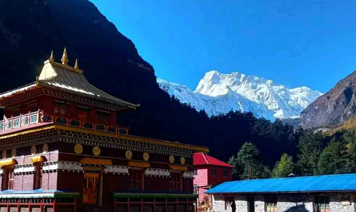
Manaslu Circuit Trek
Two weeks around the eighth-highest mountain on earth, on a trail that still carries more mules than trekkers.
Soul to Summit – A Mindful Journey to Serang and Pungyen
Walk the ancient trails of Nubri, where the Himalayas hold stories of faith, stillness, and timeless wisdom.
Tsum Valley Trek
A hidden valley on the Tibetan border, closed to visitors until 2008 and still bound by a vow against killing animals.